Mission 2
Researching, Collaborating, and Discovering World societies and history through the viewing of 360 panoramic photos and engagement with interactive, mixed media, geography maps created by collaborative learners.
Task 1
Research countries around the world
using the interactive map.
Task 2
Create an interactive map of a country
using Google Maps or ZeeMaps.
Task 3
Develop panoramic creation skills using various tools.
Upload panorama to Dermander, YouVisit, or other method.
Task 4
Add Panoramic Photo Links
to your Interactive Geography Map.
Task 5
Share your interactive geography map
by copying and pasting map URL and sending via email.
Task 6
Explore student created interactive and media rich geography maps.
Task 1
Research countries around the world using the ZeeMaps interactive map.
Watch accompanying videos, explore the Arounder.com and Air Pano panoramic photos, and read textual information of facts and history of each country.
Research countries around the world using the ZeeMaps interactive map.
Watch accompanying videos, explore the Arounder.com and Air Pano panoramic photos, and read textual information of facts and history of each country.

.
Task 2
Create an interactive map of a country using Google Maps or ZeeMaps
The map should contain links to points of interest, major cities, historical locations, and information about influential and historical people.
Links can be video, text, or websites containing relevant information and media rich resources.


|
Be sure to familiarize yourself with google Maps through Google "Take a Tour" Link
|
Task 3
Explore the 360 panoramic photos found at the following websites. Find 360 panoramas to embed as links within your interactive geography map.
Explore the 360 panoramic photos found at the following websites. Find 360 panoramas to embed as links within your interactive geography map.

Arounder
Arounder.Com
|
World Tour 360
WorldTour360.Com
|
Air Pano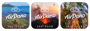
|
Task 4
Explore YouTube and You Tube 360 to discover quality educational videos to embed in your interactive geography map.
This will add to the interactivity, visual appeal, and overall educational quality of your project.
Explore YouTube and You Tube 360 to discover quality educational videos to embed in your interactive geography map.
This will add to the interactivity, visual appeal, and overall educational quality of your project.

|
You Tube 360
|
Task 5
Share your interactive geography map by copying and pasting the map's URL and sending it to your instructor via email.
Share your interactive geography map by copying and pasting the map's URL and sending it to your instructor via email.
Task 6
Explore the student created interactive and media rich geography maps displayed below.
Explore the student created interactive and media rich geography maps displayed below.
Student Created
Interactive Geography Maps
~Work in Development~

|
360 Virtual Worlds Theme Park
Created by Richard Cottone M.A.Ed. Instructional Technology Austin Peay State University Candidate for Ed. D. Educational Technology Leadership New Jersey City University Contact: [email protected] www.richlifelearning.com |
|
